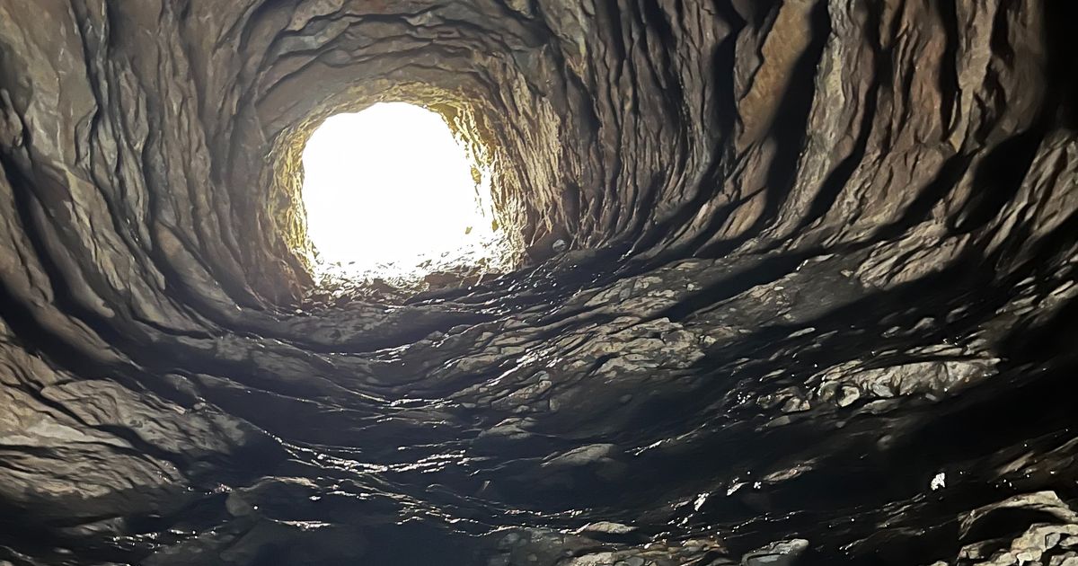
Sharp eyed people passing through the slate landscapes of Ffestiniog may have spotted a hole in the grey hillside above the community of Tanygrisiau.On closer inspection a manmade track can be seen running from the banks of Tanygrisiau reservoir to the tunnel opening hundreds of feet above it.
This is the Wrysgan quarry incline that was built in 1850 to connect the slate quarry to the Ffestiniog Railway, some 625ft below.Before it was built the quarry's products were lowered down an incline into Cwmorthin and carried onwards by pack animals.
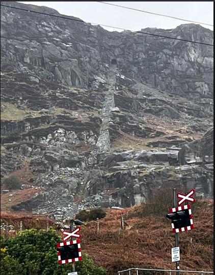
Once completed the incline was powered by a steam engine - helping return empty carts to the top as foot of the incline was too shallow to allow it to be fully self-acting. It was later replaced by electricity and finally by a lorry engine.
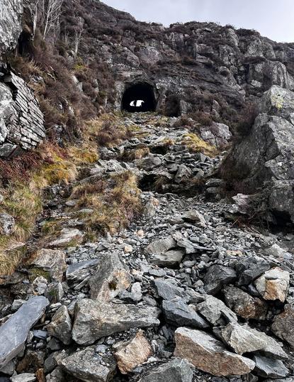
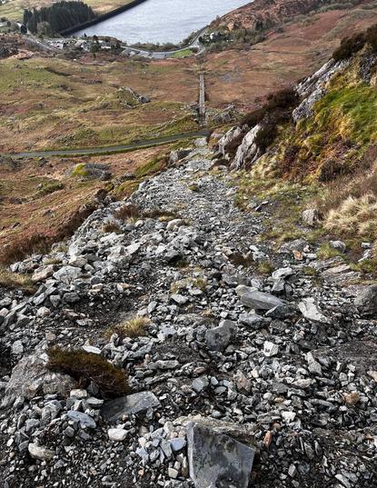
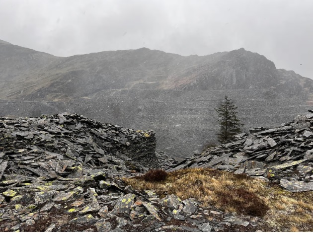
The tunnel itself provides a shelter from the elements and a place to look down on the incline and across some of the communities forged from the slate industry. Emerging on the other side walkers enter a lost world in the remnants of Wrysgan quarry - sitting some 1,390 ft above sea level.
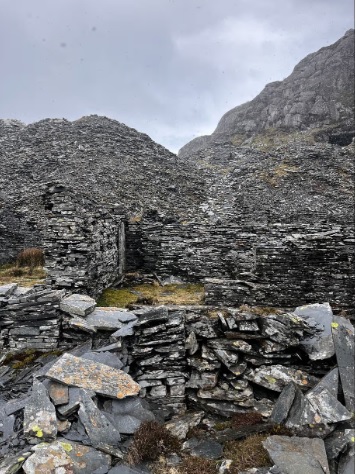 There's the former barracks that housed workers and the old mill. Old adits into the former slate caverns can also be seen.
The quarry did not exist in isolation with the Cwmorthin and Rhosydd quarries in the vicinity - with hundreds once employed these often dangerous sites.
Work may have come to a halt many decades ago but they offer a glimpse into the harsh conditions these men faced as part of Wales' famous slate industry that helped roof the world.
There's the former barracks that housed workers and the old mill. Old adits into the former slate caverns can also be seen.
The quarry did not exist in isolation with the Cwmorthin and Rhosydd quarries in the vicinity - with hundreds once employed these often dangerous sites.
Work may have come to a halt many decades ago but they offer a glimpse into the harsh conditions these men faced as part of Wales' famous slate industry that helped roof the world.
The quarry - which at peak employed around 100 workers over eight levels - remained open until 1946. It was closed and the incline's workings also came to a halt.Despite many decades having passed the rocky incline - partly reclaimed by nature remains, along with some of the old machinery that powered it. It is a steep ascent to the rock cut tunnel in the hillside, carved out by workers more than 150 years ago.
Most are still visible in the landscape, but the enlargement of Llyn Stwlan destroyed the sixth incline, parts of the fifth and seventh, and much of the abandoned mill area, which was located between the fourth and fifth inclines, rather than at the quarry level, in order to benefit from the water supply provided by the lake. There are a number of inspection hatches and electric cabinets on the inclines, which are presumably connected with the power station infrastructure.
To the north-west, on the other side of Moelwyn Mawr, lies the Croesor Quarry, where extraction of slate ceased in 1930. Following the end of the Second World War, the quarry was operated by Cookes Explosive, a local firm based at Penrhyndeudraeth, who used its underground chambers to store explosives, mainly propellants. In 1971, the Central Electricity Generating Board became aware of this use, and calculated that if there was an explosion underground, either of their two dams could be damaged. They therefore drained both reservoirs, and Cookes began removing about 250 tons of explosives per week, which were taken to Penrhyndeudraeth or by rail from Blaenau Ffestiniog railway station to various other ICI Nobel works in the United Kingdom.
Tanygrisiau, or more properly 'Tan y grisiau', is Welsh for "below the steps", referring to the stepped cliffs above the village. Tanygrisiau was famous for its slate mining, producing a high quality black slate that was used across the world. The major quarries above the village were Cwmorthin, Wrysgan and Conglog
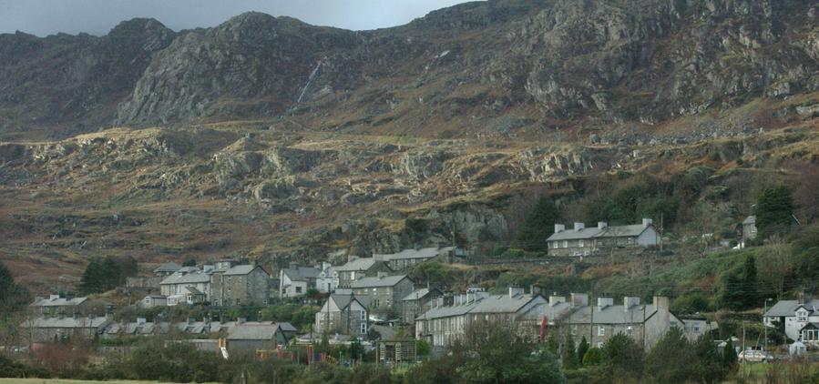
Tanygrisiau is a village and area within Blaenau Ffestiniog in the upper end of the Vale of Ffestiniog in the county of Gwynedd, north-west Wales (52°59′12″N 3°57′25″W). It can be found along the southern side of the Moelwyn mountain range and dates to around 1750. It joins onto the semi-urban area of Blaenau Ffestiniog, and is in the community of Ffestiniog; located between 650 feet (200 m) and 750 feet (230 m) above sea level.
The closure of the slate mines during the late 1970s led to massive depopulation of the area from which it has only recently (2005) begun to recover.
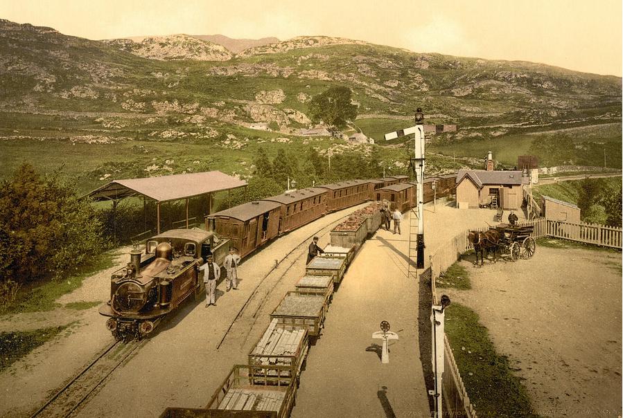
Tanygrisiau railway station is on the Ffestiniog Railway, a narrow gauge railway built to carry slate from the mines down to the sea at Porthmadog where it was shipped all around the world, mostly for use in roofing.
The Ffestiniog Railway (Welsh: Rheilffordd Ffestiniog) is a heritage railway based on 1 ft 11½ in (597 mm) narrow-gauge, in Gwynedd, Wales. It is a major tourist attraction located mainly within the Snowdonia National Park.
The railway is about 13½ miles (21.7 km) long and runs from the harbour at Porthmadog to the slate mining town of Blaenau Ffestiniog, travelling through forested and mountainous terrain. The line is single track throughout with four intermediate passing places. The first mile of the line out of Porthmadog runs atop an embankment called the Cob, which is the dyke of the polder known as Traeth Mawr.
The Festiniog Railway Company, which owns the railway, is the oldest surviving railway company in the world. It also owns the Welsh Highland Railway, which was re-opened fully in 2011. The two railways share the same track gauge and meet at Porthmadog station, with occasional trains working the entire 40-mile (64 km) route from Blaenau Ffestiniog to Caernarfon.
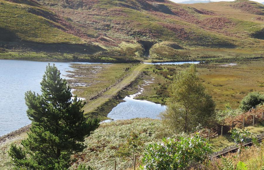
Restoration of the Ffestiniog Railway as a tourist railway had begun in 1952, but the construction of the power station would sever the link between Porthmadog and Blaenau Ffestiniog by flooding the northern portal of the Moelwyn Tunnel and the trackbed to its north, and constructing access roads along the trackbed to the south of Tanygrisiau station.
Railway restoration was in its infancy in Britain, and although the Ffestiniog Railway opposed the Bill during its final stages through Parliament, the scheme was written off as "old gentlemen and boys playing trains". The Act of Parliament to authorise the power station was granted on 16 May 1955. The Railway received a "Notice to Treat" on 5 February 1956, and a "Notice to Enter", which can normally be up to three years after the first notice, on the following day. Moelwyn Tunnel was requisitioned on 2nd June 1958, with two days between the notices.
The Ffestiniog Railway began legal proceedings to obtain reasonable compensation for the loss of their line in 1956, and it had become the longest case in British legal history by the time it was finally settled in 1972, sixteen and a half years later.
Relationships between the two parties were not good in the early days, as the CEGB were convinced that the Ffestiniog Railway board had bought a moribund railway in order to pocket the compensation themselves.
Charles Goode produced plans for a new route along the western side of the lake, which it was agreed would be incorporated into the plans. However, the CEGB then moved the location of the switching station, rendering the route impractical, and the consulting engineers Livesay & Henderson produced an east side route, which was much more expensive to implement.
The Ffestiniog Railway was aiming for "equivalent reinstatement", where the British Electricity Authority, subsequently the Central Electricity Generating Board, would pay the full cost of building a replacement route. Based on the cost of the east side route, the Lands Tribunal ruled that equivalent reinstatement would only be justified if passenger number were to rise from 76,000 to 196,000, which was not deemed to be "within the bounds of the possible", despite the fact that these figures were reached in 1967.
Eventually, a scheme called "deferred maintenance" was devised, and formed the basis for the final payout.
Pressure was applied to the CEGB during the final hearings at the Lands Tribunal, to allow a west side route, and the Ffestiniog Railway were awarded £65,000, an interest payment of £30,000, and legal costs.
The full text of the decision is published in Brian Hollingworth's book, and fills fifteen pages. Whereas most of the reinstated route, which included a spiral at Dduallt and a new Moelwyn Tunnel, was built by volunteers, the section immediately behind the power station was built by Sir Alfred McAlpine (Northern) Ltd, as it included four buried bridges to carry the trackbed over the inlet penstocks to the power station.
The nearby Ffestiniog Power Station, the high Stwlan Dam and Llyn Ystradau, colloquially known as Tanygrisiau Reservoir, are part of a pumped storage hydroelectricity installation. Much nearer the railway station is a waterfall on the Afon Cwmorthin and below the falls, and powered by a different water source, is a very small hydro-electric power station.
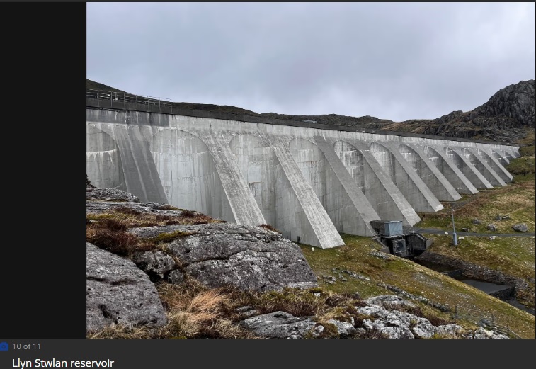
The Ffestiniog Power Station is a 360-megawatt (MW) pumped-storage hydroelectricity scheme near Ffestiniog, in Gwynedd, north-west Wales. The power station at the lower reservoir has four water turbines, which can generate at full capacity within 60 seconds of the need arising. The scheme has a storage capacity of around 1.44 GWh (5.2 TJ) at maximum output for four hours, and the capacity to power the whole of North Wales for several hours.
The station, commissioned in 1963, was the first major pumped storage system in the UK.The upper reservoir is Llyn Stwlan, 170,000 cubic metres (6,000,000 ft3), which discharges 27 cubic metres per second (950 cu ft/s) of water to the turbine generators at the power station on the bank of Tanygrisiau reservoir. The building of the lower reservoir increased the size of Llyn Ystradau and flooded the route of the Ffestiniog Railway which had to build a deviation around the reservoir and power station.
The plant is operated by First Hydro, a UK company owned by a joint venture of International Power and Mitsui & Co., and has an average efficiency of 72–73%, i.e. it uses 39% more electricity (when pumping the water back up to the Llyn Stwlan) than it actually produces.
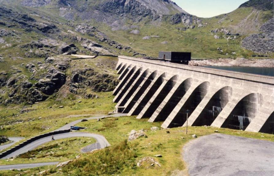
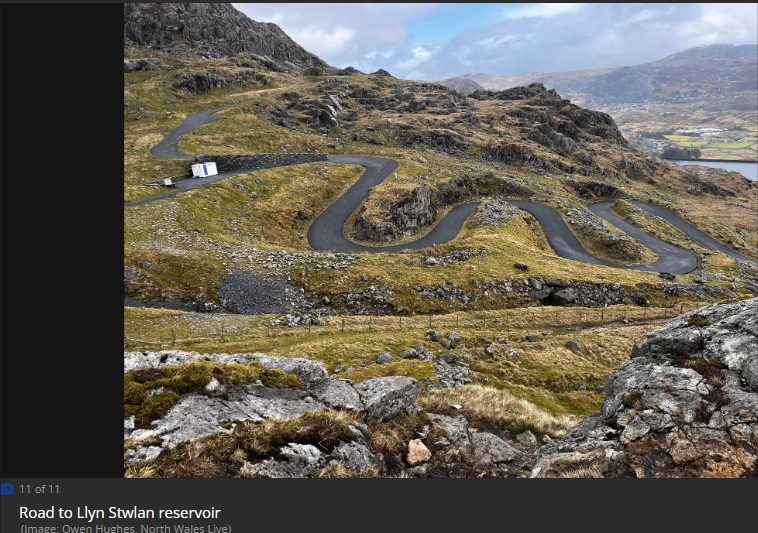
The idea of using pumped storage as a way of coping with rapid, short-term changes in the demand for electricity in England and Wales was first considered in 1948, and having found a suitable site, the Ffestiniog station was authorised by an act of Parliament, specifically the North Wales Hydro-Electric Power Act 1955. The first task facing engineers was to provide access roads to the sites, and work on constructing these started in 1957. This enabled work to commence on the two dams and the power station shortly afterwards. A pumped storage scheme requires two reservoirs at different levels, and the upper reservoir was created by enlarging Llyn Stwlan, high up on Moelwyn Mawr. Llyn Stwlan was located in a cirque basin, formed by glacial erosion.
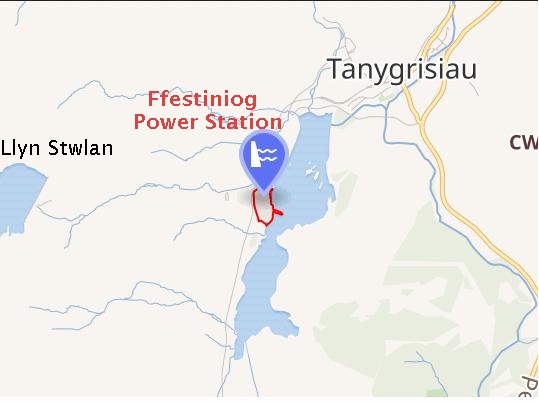
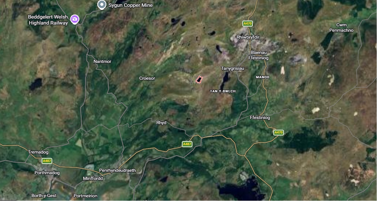
MAP OF AREA
© dailypost.co.uk&wikipedia.org
